WONDERS AROUND THE WORLD
Bryce Canyon National Park
ここはユタ州南西部にあるブライスキャニオン国立公園。
This is Bryce Canyon National Park in southwestern Utah.
断崖絶壁の縁にある展望台からは、眼下に赤、オレンジ、白の大小さまざまな奇岩郡が地平線の彼方まで並んでいるのが見える。
From its cliff-edge lookouts, you can see red, orange and white rock formations of various sizes stretching to the horizon below.
これらは自然が1000万年かけて形成した「フードゥー」と呼ばれる岩柱だ。
Formed by nature over 10 million years, the rock columns are called hoodoos.
崖がすり鉢状のこのエリアは円形劇場と呼ばれ、国立公園のハイライトだ。
This area of bowl-shaped cliffs, called amphitheaters, is the park's main attraction.
縁の標高は2400m以上ある。
This rim is over 2,400 meters in elevation.

標高が高いため、地層に染み込んだ水分は凍結して岩の割れ目を押し広げる。
Due to the high elevation, moisture in the rock strata freezes, widening cracks.
このサイクルが、長年にわたり何回も繰り返されたため、
もろい部分が内部から破壊され、独特な形の奇岩群が生まれた。
This process, repeated many times for eons,
has destroyed weak parts of the rock from within,
creating unique formations.
城を取り囲む塔のようにも見える数千本のフードゥーは、
太陽光線の傾きによってゆっくりと表情を変える。
Looking like castle towers,
the thousands of hoodoos slowly vary in complexion
as the angle of sunlight changes.
朝日や夕日に染まる尖塔群の美しさは格別だ。
The spires are truly lovely when tinged by a rising or setting sun.
特に朝日の光景は米国の国立公園でも有数と評されている。
The views at sunrise, in particular,
are rated among the best in any of America's national parks.
South Moravia
波打つような緑の絨毯がはるか地平線まで広がっている
ーなだらかな曲線を描く丘陵が、まるで押し寄せてくる緑の津波のようだ。
An undulating carpet of green stretches to the horizon
--- gently curving hills like a surging green tsunami.

ここはチェコ南西部の南モラビアにある田舎町キヨフ、
首都プラハから鉄道で4時間ほどだ。
This is the country town of Kyjov, South Moravia,
in the Czech Republic's southeast, about four hours by train from the capital, Prague.
丘陵は遠目には草原のように見えるが、
実際は一面に広がる小麦畑だ。
From a distance, the hills look like grassland,
but in fact they're covered in wheat fields.
この辺りはかつて鉱山として栄え、
その後、畑が採掘跡だった起伏のある地形の上に作られたため、
このような独特な美しい風景が生まれた。
The region once thrived on mining,
after which these fields were established on the rolling terrain of the former mine sites,
creating this unique, lovely landscape.

一面が緑に染まるのは5〜6月。ただし、一年で一番美しいのは5月上旬で、
一帯は緑のむぎと黄色の菜の花で覆われる。
This area is green in May and June,
but the annual height of its beauty is in early May,
when it's blanketed in green wheat and yellow rapeseed blossoms.
辺りを散策するにはサイクリングがいい。
南モラビアは上質なワインの産地としても知られ、
地元のワイナリーを巡るサイクリングコース「ワイン街道」が整備されている。
絶景とワインを楽しむのにうってつけだ。
The area is perhaps best explored by bicycle.
South Moravia is also known for producing quality wine,
and its Wine Trails cycling routes, built for touring the local wineries,
provide an ideal way to enjoy the scenery along with the wine.
The Valensole Plateau
夏の強い日差しの下、紫色の畝が地平線まで続いている。
毎年初夏になると、パリから約800km離れたフランス・プロバンス地方のバレンソール高原は、
ラベンダーの紫色とその甘く爽やかな香りに包まれる。
Purple ridges stretch off to the horizon under a blazing summer sun.
Every year in early summer, the Valensole Plateau,
some 800 kilometers from Paris in France's Provence region,
is bathed in the color and sweet, fresh aroma of lavender.

世界有数のラベンダー栽培地であるプロバンスには、
栽培畑をめぐる約1000km に及ぶ「ラベンダー街道」と名付けられた道がある。
標高約600mのバレンソール高原も、
この街道沿いにあるプロバンス随一のラベンダー栽培地。
One of the world's leading lavender-producing areas,
Provence has around 1,000 kilometers of road through its fields,
known as the Lavender Routes. The Valensole Plateau, about 600 meters above sea level,
is among the finest areas of Provencal lavender along those routes.
幾重にもラベンダー畑が広がり、紫のじゅうたんを敷き詰めたような光景は
多くの観光客を集める南仏の風物詩だ。
石灰質の乾いた大地が広がるバレンソール高原では、
ラベンダーがやせた土地でもよく育つため、栽培がこれほど盛んになったという。
The scenery of countless lavender fields like wall-to-wall purple carpet
is one of the tourist-magnet seasonal delights of summer in southern France.
The plateau has dry, limy earth, and lavender farming became so successful there
because the plant grows well even in such poor soil.

花の見頃は7月から8月。
その時期には、ラベンダーが黄色いひまわりと並んで咲き誇る光景が見られる。
The best time to view the flowers is July and August,
when you can see them in full bloom alongside yellow sunflowers.
The Moeraki Boulders
大小さまざまな丸い巨石が、夕暮れ時の海岸の波打ち際に点在している。
大きなもの高さ2m以上、重さは数トンにも達する。
不思議な存在感を放つこれらの巨石は、ニュージーランド南島の南東部、南太平洋に面したコエコへビーチにある。
Round boulders of all sizes strew a beach at dusk, butted by waves.
The largest are over 2 meters tall and weigh several tons.
These mysterious giant stones are on Koekohe Beach,
which fronts the South Pacific Ocean in the southeast of New Zealand's South Island.

生物の死骸が海底で腐敗すると、有機物の酸が染み出す。
これが海水中のカルシウムと反応して炭酸カルシウムができる。
反応は周囲に向かって均等に進むので、炭酸カルシウムの塊が球形に発達し、
死骸を覆うように丸く成長して、球状の岩石が作り出されるという。
Biological remains decaying on the sea floor release organic acids
that react with calcium in the water to form calcium carbonate.
Since the reaction occurs uniformly in all directions,
each mass of calcium carbonate grows spherically,
encasing the bioremains as it grows into a rock ball.
球状岩石(コンクリーション)の形成には、
以前は数万年から数百万年かかるとされていたが、
日本の研究者が近年、大きなものでも数年でできることを明らかにした。
The formation of spherical concretions was previously thought to take tens of thousands to millions of years,
but researchers in Japan recently found that even large ones can form in just a few years.
実は、球状岩石は世界各地の海岸で見られ、
北海道や宮崎県などでも見つかっている。
Actually, spherical concretions can be seen on coastlines the world over,
and some have been found in such places as Hokkaido and Miyazaki Prefecture.

The Tuamotu Archipelago
大南太平洋のフランス領ポリネシアにはタヒチやボラボラ島をはじめ
『楽園』と呼ばれる島々がいくつも存在する。
やはりフランス領ポリネシアに属するトゥアモトゥ諸島は80ほどの島や環礁から成り、
それはニュージーランドの北東約4800kmのところに点在している。
この諸島は世界でも最も環礁が多い地域である。
French Polynesia in the South Pacific has many islands described as paradises,
such as Tahiti and BoraBora.
There's also the Tuamotu Archipelago,
around 80 islands and atolls that dot an area some 4,800 kilometers northeast of New Zealand.
This is the most numerous collection of atolls in the world.

サンゴ礁からできている環礁を形成している外縁の陸地の幅はとても狭く、
その多くが幅1kmにも満た無い。
そのため、トゥアモトゥ諸島の陸地の総面積は、
860平方メートルほどしかない。
Made up the coral reefs, the rings of land that form the atolls are very narrow,
most less than a kilometer wide.
As a result, the archipelago's total land area is only about 860 square kilometers.
この諸島の中で、特に注目に値するのがランギロア環礁。
琵琶湖の2.5倍以上の広さを誇る、世界最大の環礁の1つで、ダイビングの聖地として有名だ。
そこではマンタやイルカをはじめ、
サンゴ礁に生息する色鮮やかな魚との出会いが楽しめるとあって世界中からダイビング愛好家が集う。
A notable member of the archipelago is Rangiroa.
With an area more than 2.5 times Lake Biwa's,
this is one of the world's largest atolls and is a renowned location for diving.
Offering chances to see such creatures as manta rays,
dolphins and the colorful fish that live in its coral reefs,
Rangiroa attracts diving enthusiasts from all over the globe.
Gullfoss

膨大な量の水が、轟音を立てながら流れ落ちる。
水煙が立ち上がり、滝をまたぐ虹が現れる。
A vast amount of water pours down with a roar.
As spray drifts up, a rainbow appears across the waterfall.
北極圏に近く、氷河が多いアイスランドには1000以上の滝があるが、
中でも最も美しいと随一の人気を誇るのがグトルフォスで、首都レイキャビクから車で2時間ほどだ。
グトルフォスという名はアイスランド語で「黄金の滝」の意味で、
晴天時に滝が黄金に輝くことから名付けられた。
Close to the Arctic Circle and home to many glaciers,
Iceland has over 1,000waterfalls, and admired above all as the most beautiful is Gullfoss,
about two hours' drive from the capital, Reykjavik.
The name Gullfoss means "golden falls" in Icelandic
and was given to the waterfall for the golden gleam it has in sunny weather.
同国最大級の氷河を水源とするグトルフォスは、水量豊かな2段滝で、幅約70m、合計落差は約30mある。
Fed by one of the country's largest glaciers, Gullfoss is a high-volume,
two-stage waterfall some 70 meters wide and with a total drop of about 30 meters.
夏には氷河から溶け出た青く澄んだ水が、水煙を上げて流れ落ちる。
冬には様相が全く異なり、流れ落ちる勢いは同じでも、一部が凍りつき、周囲は雪に覆われる。
どちらも驚くほど美しい光景だ。
In summer, the clear-blue glacial meltwater throws up clouds of spray as it cascades down.
In winter, the scene is very different, the falls flowing with the same force
but with some parts frozen and snow all around.
In either case, it's a stunning sight.
9月から翌4月には、運が良ければ、
滝の上空にオーロラが現れる幻想的な光景を見ることができる。
Between September and April, with a little luck
you can catch the magical spectacle of auroras in the sky above the falls.

Malham Cove

縦横に深く不規則な亀裂が入った石灰岩にサンザシの老木が立っている。
曇天を背景に夕日でオレンジ色に染まった光景には、寂寥感が漂っている。
An old hawthorn stands in limestone crisscrossed with deep, irregular cracks.
Tinged orange by the setting sun and backdropped by a cloudy sky, it's a desolate scene.
ここはマラムコーブと呼ばれる断崖絶壁の頂上部で、
イングランド北部のヨークシャーデールズ国立公園にある。
香川県ほどの面積があり、緑豊かな丘陵地帯や荒野が広がる同公園の中で、
マハムコーブの景観は独特で、ハリーポッター映画のロケ地にもなった。
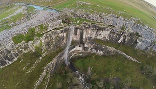
This is the top of Malham Cove, a bluff in Yorkshire Dales National Park, northern England.
While the park, about the size of Kagawa Prefecture, has lush hills as well as wilderness areas,
Malham Cove is distinctive among its landscapes
and was used as a location for one of the Harry Potter films.
最後の氷河期の後、後退する氷河が土壌を削って露出させた石灰岩を大量の水が侵食し、
高さ約80m、幅約300mの断崖絶壁を作り出した。
その頂上部では石灰岩の割れ目に沿って水が流れ、
長い間に深い溝を掘ったために、人工の敷石のような表面が形成された。
After the last ice age, a receding glacier stripped away the soil and exposed the limestone,
which vast amounts of water then eroded, creating a sheer cliff some 80 meters high and 300 meters wide.
At the top, water flowing along cracks in the limestone carved deep grooves over time,
forming a surface like man-made paving stones.
豊かな自然に加え、同公園は伝統を色濃く残す美しい村が点在、
観光客の間で隠れた名所となっている。
In addition to its rich natural environment,
the park is dotted with lovely, tradition-steeped villages
and has gained a reputation among tourists as a hidden gem.